|
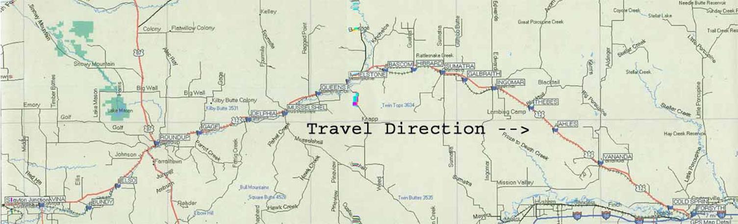
Travel the Milwaukee Road
from Slayton Junction to Fort
Sarpy
This trip requires about eight hours and
is over 300 miles in length. If weather is BAD, 4-wheel drive with MUD Tires
is mandatory; unless you want to meet with the landowner’s tractors?
Much of the area to be traversed is through pasture land. In the 1870’s
many large cattle outfits from Texas
drove their vast herds into the area to feed on the rich grasses for winter
feeding. This feeding frenzy continued on past 1902 when 25,000 head of
cattle were trailed through the region, passing alongside of the Musselshell River
and onto Canadian open ranges in Saskatchewan.
By 1903 homesteaders had flocked into the regions, and the available
“free” grasses were no more. The Milwaukee Road operated under the name
of “Milwaukee and Waukesha Railroad” when incorporated
in 1847. The name was soon changed to “Milwaukee
and Mississippi
Railroad”. This line essentially paralled the NPR route in Montana, and
many questioned the wisdom of that act, but the directors believed it was
necessary to reach the Pacific if they were to remain in business. The extension was approved in 1905, and $60
million was appropriated for construction. They completed 2,300 miles of
track in only three years. Additional improvements added another $257
million, and forced the company into bankruptcy in 1925. By 1907 the track
was operational in the area covered by this trek. Coal from the Bull Mountains
fed the engines. The company was originally headquartered in the Railway Exchange
Building in Chicago
until 1924, when they moved to the Chicago
Union Station. After reorganization,
the company launched an advanced version of their famed Hiawatha passenger
train, which was capable of traveling over 100 mph. In 1927 the company built
the Gallatin Gateway Inn, and reorganized again as the “Chicago, Milwaukee, St Paul and Pacific
Railroad.” In January 1928 the name was changed to “The Milwaukee Road.”
The following year, the great depression hit, and the line was in serious
trouble. In 1935 they filed for bankruptcy, and operated under trusteeship
until December 1, 1945. After WWII the
line was restored and the engines dieselized, replacing its fleet of steam
and electrified locomotives. In association with the Union Pacific, the line
took over operations of the “Cities” passenger trains in LA, San Francisco, Denver and
Portland in
the late 1950’s. The line section passing through the Musselshell
area and into Forsyth and adjoining regions was eliminated for travel during
the 1920’s: the track and the ties were removed in the late
1970’s. The full line finally failed in 1986, and was taken over by the
Soo Line.
This trek
traverses alongside of the abandoned railroad line, and the route grade
levels are clearly visible throughout the tour. With few exceptions, the
former rail station towns and post offices have long vanished. Virtually all
of the land is relatively flat as it passes through the agricultural area.
Pictures of landscape & visible remains of the railroad grade and some
bridges along the travel route show a rather bleak ending to a gallant old
line. There are numerous sources available that discuss the origins of the
towns and their past history & local genealogy – so that detail
won’t be presented; excepting for some obscure tidbits. There is a need
to clearly present these towns’ history for all to cherish. Some have
been researched and we all thank the individuals for their efforts. If anyone
cares to present a detailed or interesting account about any of these towns;
I will be glad to post on the Internet for you, including scanning of your
material to as-is if desired (Cost is $0.00) for this service – along
with the appropriate search indices. After viewing the local area, I find
that an in-depth evaluation of the ancient sites and examination of available
records is vital to our true Montana
History.
In 1851 the
Government took first steps in trying to reconcile the Indian Nations concern
over land usages. This was the Fort
Laramie Treaty of 1851.
Although it was signed and agreed by all local Indian Nations’ leaders,
including the Sioux, when it was presented to the US Senate for final ratification,
it was rejected. After eleven years of secret debate, the document was
printed and sent to storage. Apparently this careless action initiated the
forthcoming starvation and deaths to many tribal members. The area bounded by
the Musselshell river was set aside for the
Blackfoot to the north, and the Crows to the south. Later in 1868, the
boundaries were redrawn, and much of the land became Public Domain. This
fertile valley spawned much Indian Rock Art.
|
|
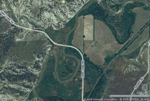
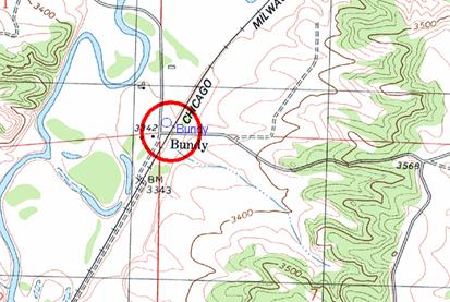
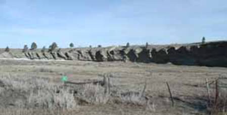
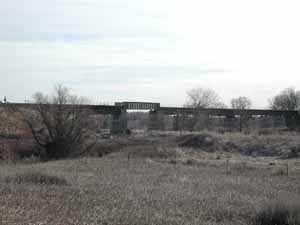 Slayton Junction Slayton Junction
The map
on the right shows the post office location and the original townsite
position in Section 2, T6N, R21E (Golden
Valley). No visible evidence of buildings’
remains, but the railroad junction itself still stands. This location is one
of the major sites for American Indian Pecked Art drawings on the rock
formations in the area. The ARARA (American Rock Art Research Association)
conducts in-depth research in the area. Prior to the founding of Billings, a large “arrow-shaped” rock called
Indian Rock,
stood at the base of the north rims, near to where 6th Ave N and the road to Boothill Cemetery intersect. It contained art
forms very similar to the ones presented in the Slayton Junction setting.
Across from the Rail overpass are unusual rock formations.
The PO operated from 4/7/1915
until 9/15/1931.
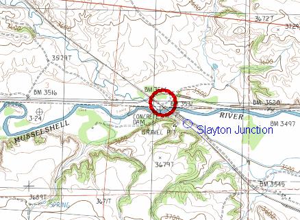
PO shown @
46.2999580 -109.0646091 : Town a short
distance east. (3514 feet)
|
|
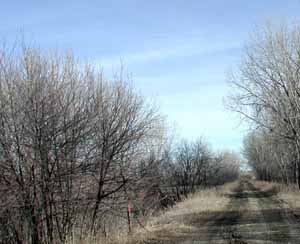
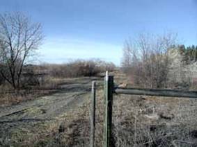 Cushman – View from the road looking south,
towards where the PO was reported to be
located. Cushman – View from the road looking south,
towards where the PO was reported to be
located.
Cushman
is the second stop. It was named after a
local ranch owner, old settler, cowboy & conductor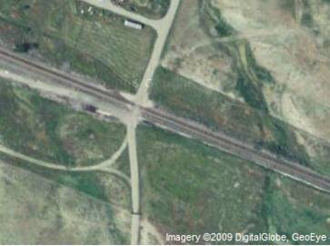 . The locale is slightly south of HWY 12. . The locale is slightly south of HWY 12.
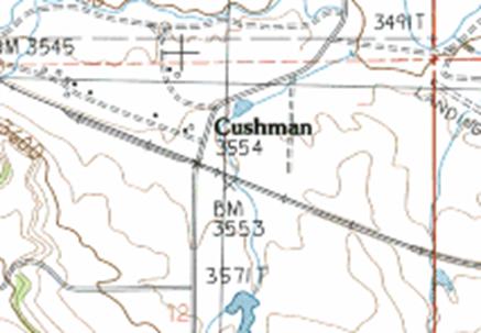
Town @
46°17'17"N 109°2'29"W
|
|
Lavina – The
Adams Hotel on Main Street
Continue west on HWY 12 and
turn south on MT 3. 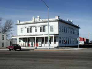 You pass the Lavina Cemetery road Enroute. For a brief
period Lavina was called White
City since the residents
liked to paint their buildings white. There are two reported reasons for the
name Lavina: One stated it was named after Lavina, a daughter of settler
Vance; the other that Lavina, a girlfriend of Walter Burke who was hired to
operate a stage stop between Fort Benton and Billings. You pass the Lavina Cemetery road Enroute. For a brief
period Lavina was called White
City since the residents
liked to paint their buildings white. There are two reported reasons for the
name Lavina: One stated it was named after Lavina, a daughter of settler
Vance; the other that Lavina, a girlfriend of Walter Burke who was hired to
operate a stage stop between Fort Benton and Billings.
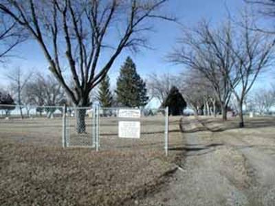 Lavina Cemetery. The PO opened
4/3/1883, and is still in use. The Lavina Stage operated between Billings and Lavina for
many years. On February 16, 1908 the train made its first stop at New Lavina. Lavina Cemetery. The PO opened
4/3/1883, and is still in use. The Lavina Stage operated between Billings and Lavina for
many years. On February 16, 1908 the train made its first stop at New Lavina.
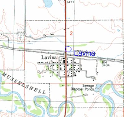
PO @ 46.2941250
-108.9382130 (3448 feet)
|
|
There are two
interesting articles published by the Billings
Gazette that tells a great deal about the area and the railroad:
“Rollin’
Down the Musselshell”, by Rick &
Suzie Graetz (11/2/2003)
“Memories
all that Remain”, by Cathy Byron (1-10-2003)
Short details on
the other sites visited on this trek are omitted. Refer to USGS coordinates
to create a personalized GPS-TREK for this event with your GPS location
device. Please refer to the referenced link above. A travel-log photo shoot
in sequence starting at Slayton Junction and continuing to Fort Sarpy,
and the Jedediah Smith road sign is contained in trek-photos.
This requires Adobe Flash 6 or greater to view. If not installed on your PC,
a link is provided to allow acquisition. Each townsite and former post office
locations are available on the USGS site, as well as aerial views.
Alternately a
full screen photo shoot with a self
executable file is available (size 11MB). Transition is set at 4
seconds/with sound.
It should be
noted that Roundup (located at the junction of highways 12 & 87), is
directly on the former site of the General
Hazen Trail, created in 1865 as a passageway between Fort Phil Kearny
and Fort Benton. Part of highway 87 follows portions of the Hazen Trail; but
most of the trail is on private lands.
|
 -
-