Monument Trail Twin Monuments
Investigation and restoration
coordinated by Vernon Drake.
Revised Saturday, June 02, 2012
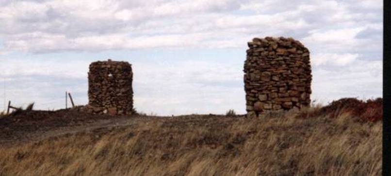
”The twin monuments were built between 1890 and 1910, when
several ranches had herds on the open range. Gus Barth,
Johnny and Jimmy Ross, Jimmy Ash, John Clanton, and Charlie Bair were big sheep
men in the region; and each had several herders watching flocks of two thousand
to two thousand five hundred sheep. The Twin Monuments were located near the
headwaters of Spring and Cottonwood Creeks, and are
nearly eight feet high. Herders working for Jimmy Ash probably erected them.
Monuments were built when herders gathered and piled stones to pass the time
while watching sheep, as their dogs did most of the herding. The monuments,
which generally were placed on knolls and could be seen for miles, were each
built somewhat differently so they could serve as markers for camp tenders, who
rode out from the main ranch to bring provisions and help the herder move his
wagon. Monuments were usually placed from a half-mile to a mile apart,
depending on the terrain. Each herd had five or six sections of land to itself.
In the late 1890's, there were more than forty herders keeping nearly one
hundred thousand sheep in the Pryor Hills. Sheepherders received forty dollars
a month and were paid once a year until a law was passed forcing sheep men to
allow herders to come to town at least every six months. Late Bill Huntington,
Western author, contended the law was passed because herders became
"touched after living too long with only sheep and dogs as companions. ' The Twin Monuments marked a collection point for
freighters, who hauled wool to the railroad in Billings in wagons drawn by horses or mules.
In 1900, when the Burlington Railroad was being built through the Gap, the lone
monument near where a microwave tower is located today served as a landmark for
Red Eye Smith's Roadhouse, which catered to the paychecks and whims of railroad
laborers. Freighters and herders familiar with the area avoided Red Eye Smith's
because of its unsavory reputation. Many herders frequented Johnny Ross' saloon
in Billings, a
veritable herder's heaven. It even had a shed to house sheep dogs while their
masters went through a year's pay. Settlers began arriving in the hills around
1910, and the sod was pretty well overturned by 1915 in what used to be open
sheep country. Nesters took some rocks from one of the monuments to use as
corner markers for homesteads. A few other rocks ended up as foundations or
chimneys. Although warned that nooks in the monuments were good homes for
rattlesnakes, children found the fragile towers ideal playgrounds and
contributed to the monuments' demise. Kids went out at night to knock over
other nearby monuments for fun, and exposure to wind and weather took their
toll. By the mid-l950's, only the Twin Monuments, the
tower next to the microwave station, and few others remained. Nearby residents
treated the surviving towers with a sense of tradition and respect, and they
remained untouched for several years.”
Although the early reports indicate that sheepherders constructed this,
later analysis indicates that it held a more prominent position. After the Crow
reservation was opened for settlers, the wagon roads that criss-crossed
throughout the region began to take on names. The one passing southeast down
the Doss Hill (land on which these monuments sat) was called Hog’s Back Road, and it
went to Bridger. It intersected with Spring
Creek Road and Monument Trail (McCormick’s
Road), Cottonwood Trail and Duck
Creek Road. It was the main intersection of access
to the South Hills plateau from the Pryor
Valley floor.
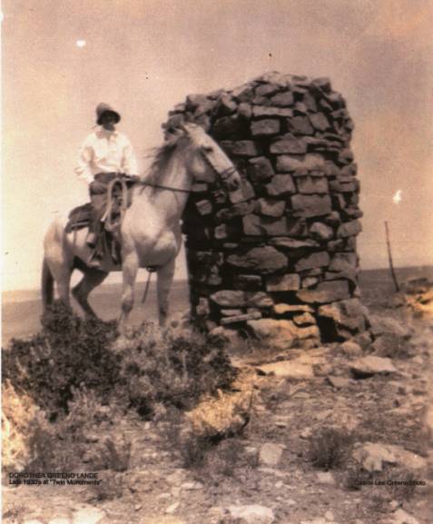
This picture of Dorothy Greenough was taken around 1930. She is next to the
northern most monument, the one that was destroyed,
and rebuilt in 2002 by Vernon
Drake and other members of the Historical Society, local ranchers and
Pioneers of Eastern Montana. The other monument, near to the edge of the
canyon, has a “one-half inch diameter bore-sight” within its
perimeter. It points directly towards the high point
marker of Yellowstone
County. There used to be
a nearby stone cairn on the property that marked the sight-line. Note: Occasionally, some visitors jam a
pebble over the bore site. The entrance is located about four feet from the
base, and about six-inches to the right of the centerline when facing Stratford
Hill.
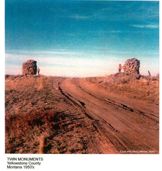
In 1950, the monuments looked like this: (View looking towards the west)
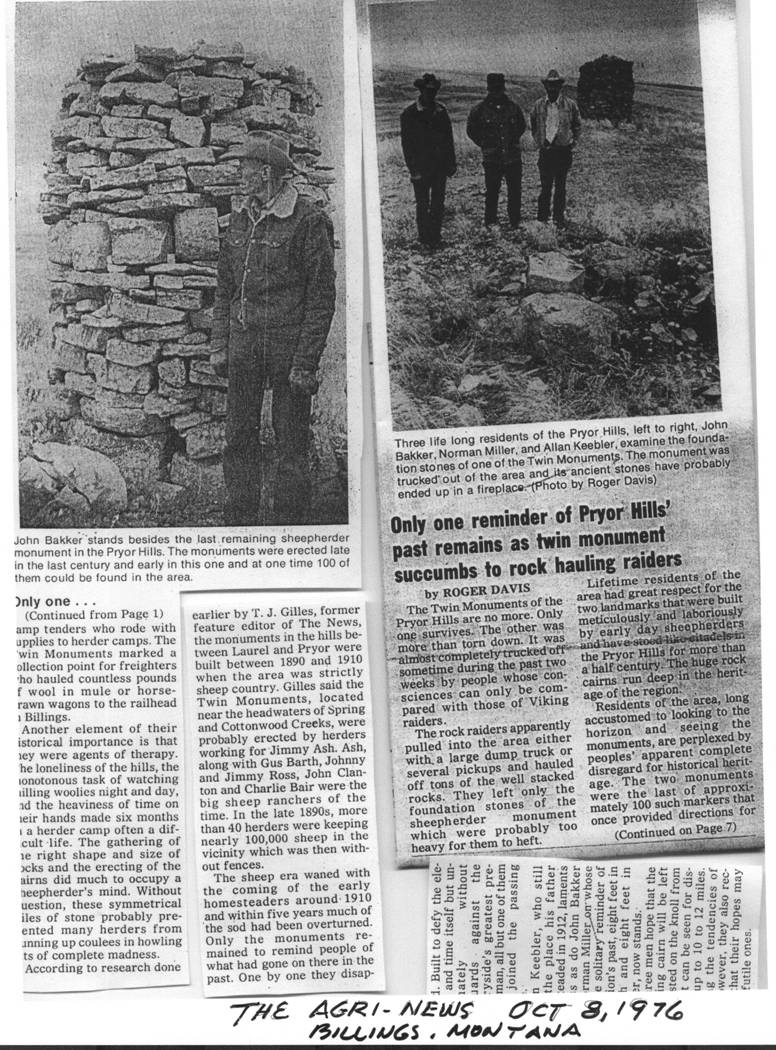
In 1976 the local ranchers reported the vandalism and theft of the
rocks that formed the northernmost cairn.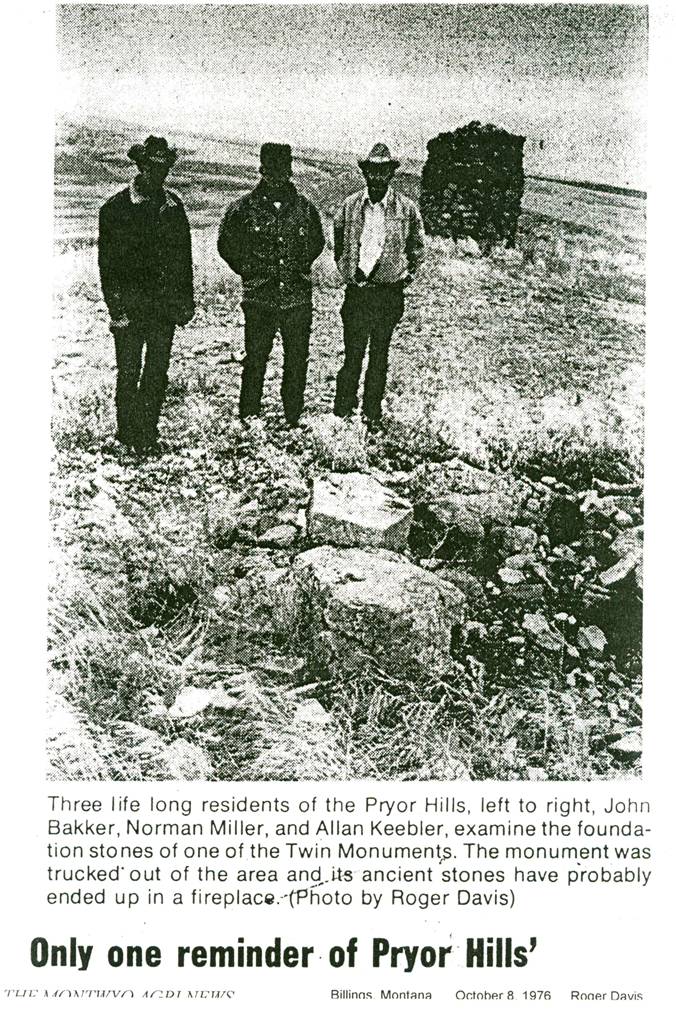 This act of coward’s vandalism prompted Vernon Drake to solicit research
funds from the Western Heritage Historical Society (refer to the article by
Vernon Drake noted above) to rebuild it.
This act of coward’s vandalism prompted Vernon Drake to solicit research
funds from the Western Heritage Historical Society (refer to the article by
Vernon Drake noted above) to rebuild it.
This shows the restored cairn. After the first attempt, the rock formation
fell apart as the weight bearing structure had the forces going outward. I
redesigned the load pattern, with the 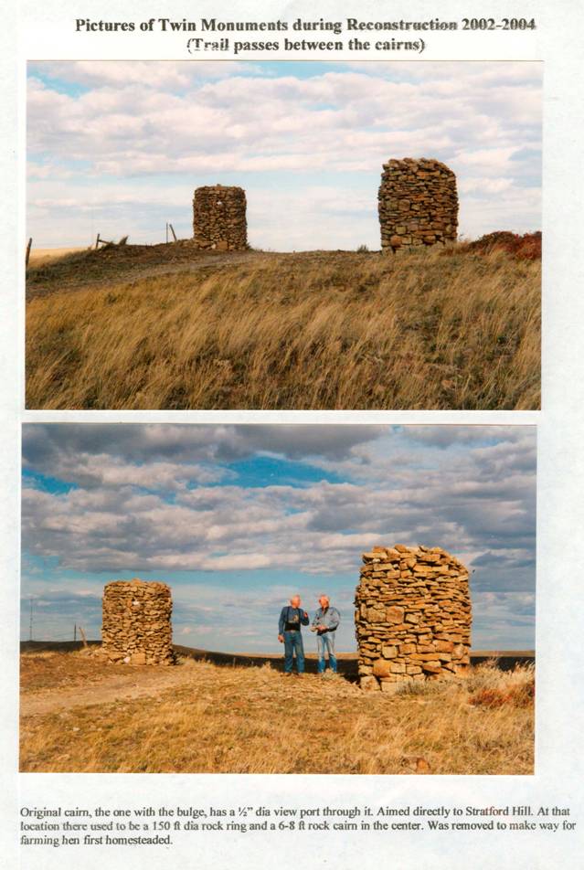 forces
going slightly in towards the centerline, and with a ring cap about four-feet
from the base to assist in maintaining the girth width. That construction was similar
to the remaining cairn. (View is looking towards the northeast)
forces
going slightly in towards the centerline, and with a ring cap about four-feet
from the base to assist in maintaining the girth width. That construction was similar
to the remaining cairn. (View is looking towards the northeast)
After Vernon Drakes death, his son’s placed a memorial plaque at the
site to depict the Bozeman Military
Trail passageway.
 Email
me:
Email
me:
Katy Hestand
Yellowstone County Coordinator