(Extracted from BLM/GLO Survey Records)
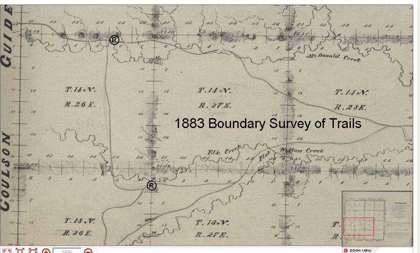
The trail continues from the McDonald Creek crossing [® location in Section 2 T14N R26E], and goes west for a distance of 17-1/4 miles to Chamberlain’s Ranch crossing in Township 15N Range 23. At that juncture there are two alternate roads.
Starting with T14N
R26E this trail segment cuts northward into T15N and travels essentially west to
R23 where it joins a cutoff called “Chamberlain’s Road” leading north to a
juncture that goes westward to the fort (Page 8). This area is also quite
congested with several trails and various options were available for travelers.
The trails in the local area go by several other names, Road to Carroll,
Chamberlain’s Road, and Chamberlain to Pike Trading Post,
This segment was in existence before the Maginnis Trail was
established for linking with

The soldiers continued following the existing road.
The last segment leading to Chamberlain’s location is finally reached. This is T15N R23E 1881.
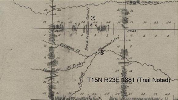
Note: 1881 was the last year for survey in this Range/Township; but the trail connection north was noted in a boundary survey for that year. The other trails leading into that juncture were established prior to the survey, but only the boundary locations are noted.
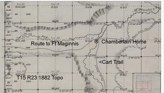
The trail for the final section exiting into