(Extracted from BLM/GLO Survey Records)
The trail continues from the Flat Willow crossing, to McDonald Creek a distance of 10- miles. Starting with T13N R26E the trail travels north to northeast where it joins a cutoff leading north to the crossing. This area is quite congested with several trails and various options were available for travelers.
Starting with T13N R26E at the Flat Willow Crossing you follow the trail north, and about two miles take the left fork leading to the cutoff and a crossing at the western edge of Elk Creek. The trail to the right and connects with other eastern locations and crosses Elk Creek about where it joins with Flat Willow Creek. Portions of the Maginnis trail in these northern regions are virtually non-existent today; but some are relatively close to existing roads and ranch trails (within 1-3 miles of the actual trail.) It appears that most of the trail has been placed under “the plow”, or erased from the maps.
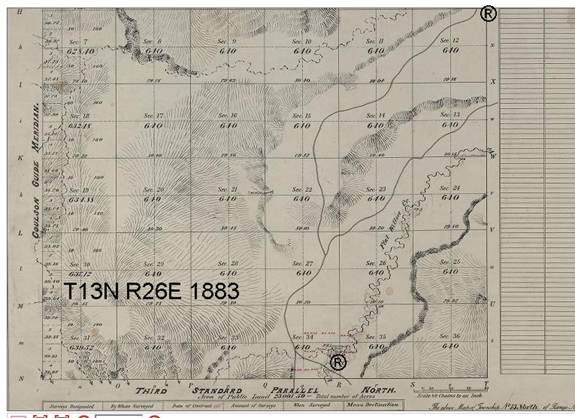
In section 1 of the T13N R26E survey plat above, the trail makes a junction with another trail segment that leads directly north to McDonald Creek and a major East-West thoroughfare. The trail is picked up in T14N R26E.
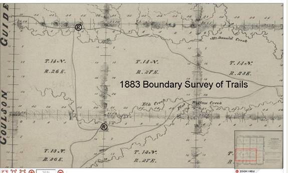
The trail for the next section continues going west along the McDonald Creek, on Page 7.