|
Mileage
|
Location and Comments
|
Photos and Descriptions
|
|
0.0
|
Harlowton, MT – depart from Ray’s Conoco Station,
heading NW-W on Hwy 12, stopping to pickup map noted above.
|
Fill up with gas, and any snacks-meals you desire
before departing. This will be a rather s-l-o-w driving trek
through beautiful country, so plan on at least 6-hours of driving &
sight-seeing. Be sure to plot out
the route before departing on this trek; as the route is not easily
located. Portions pass through private lands!
|
|
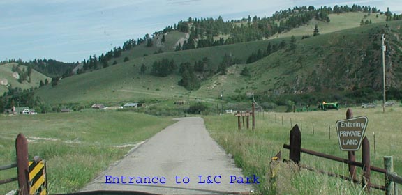
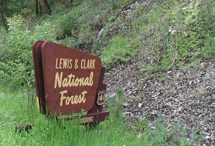
32.7
|
This is where you turn off Hwy 12 to the right
(north), and begin to enter the L&C
Park.
This 1st road is FR 274 leading to Spring
Creek. Once inside of the park, the directions will be clearer. Castle Mountain to the west, Belt to the
north-east. You will be heading towards “Russian Flats.” A park
entrance sign will appear on the east side of the road. You will pass
through three cattle guards before reaching the L&C Park
sign.
|
|
|
--Enroute to Park Entrance--
|
You will pass through three cattle guards before
reaching the L&C
Park sign. The scenes
noted will be on your right.
|
|
|
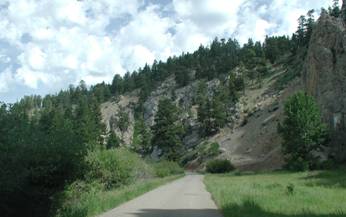
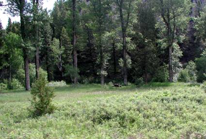
34.3
|
L&C Park Sign. From here on most of the route is easily
followed. But; beware of any “Y’s” enroute. Just past
this sign is a beautiful picnic area. There will be several more along the
route. Take time to stop and visit each – if you have the time.
|
|
|
34.8
|
This is the end of the road pavement – dirt &
gravel from now on. You will now be passing through various segments of
private land holdings. If wet – raining etc; a 4-wheeler will be
vital.
|
|
|
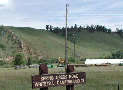
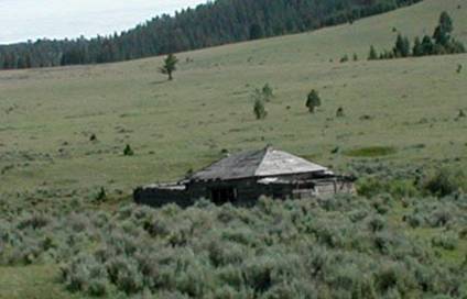
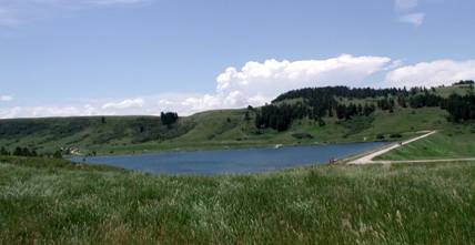
36.7
|
You have arrived at Spring Creek Campground. Con
tinue to Road 6393 sign
|
|
|
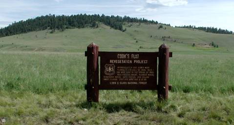
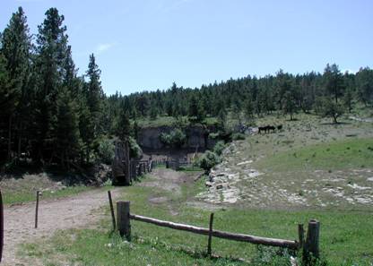
37.8
|
Road 6393 directs you to three sites. Follow this
road until directed otherwise. There will be some advisories on the way. Enroute
you will be passing by several abandoned mercury mines. The cattle seen in
the nearby land bears the TCM
Brand. You will pass by the Cook’s Flat sign. Here was planted 260
acres of the range grass you see, at a cost of $12.50/acre in 1959.
|
|
|
46.7
|
You will arrive at a junction: - keep to the left,
and follow the Route “J” symbols.
|
There will be a “58”
enclosed within a diamond sign on a post at the junction. “J”
denoting Snowmobile
Emergency-Travel Route”.
|
|
50.6
|
You were traveling on Route 174 and have arrived at a
“TEE” in the road
|
. Utica
is posted as 32 Miles to the right. Turn right!
|
|
52.6
|
You have arrived at “Daisy Notch”
|
This is in Belt Mountain Range, and is on your right.
|
|
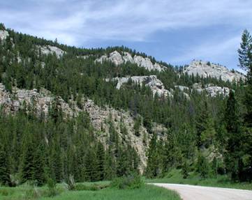
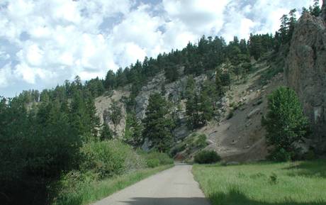
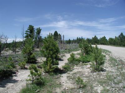
63.8
|
Some pictures of the local hilly area. You will be
entering the Judith Basin Area.
|
|
|
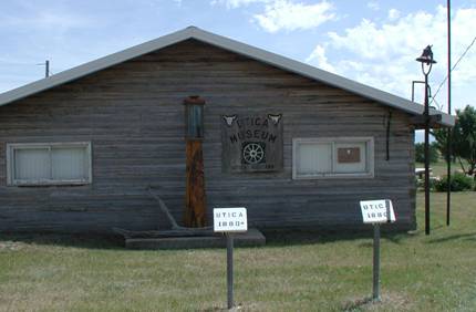
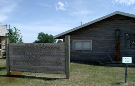
72.5
|
Sapphire Village
sign and directions to Utica.
Continue on South Fork RD
to Utica. Most
of the structures are dated and have numerous signs posted in front that
describe the building-event. The museum is shown here.
|
|
|
82.5
|
Finally – paved roads!
|
The local road you need is Hwy 239 and leads to
Hobson; about 11-miles distant
|
|
94.2
|
You will arrive at a three-way junction of MT3 –
US87 – MT200. Take MT200 and travel SE to Hwy 191 Junction about
6-miles distant.
|
Follow Hwy 191 to MT 238.
|
|
118.0
|
Take a right on MT238.
|
This is in Lewistown, and is named “1st Ave South”.
Continue on towards Heath.
|
|
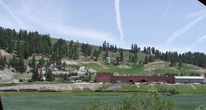
128.5
|
You are on a gravel road. The Heath Limestone Facility
can be seen across the river.
|
|
|
129.0
|
Stay to the left at the fork – there is no
sign. There are some Teepee’s on the right of the road. Look ahead
and a sign MT238 can be seen. Bear to the right (SW) and go onto Red Hill Road. The
Heath Reservoir is next on your route.
|
|
|
|
You will pass by and old school house and tree
devastation from a forest fire can be seen. You will pas by a Box Canyon. The dirt road is very rough.
|
|
|
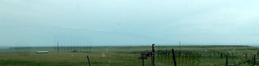
|
Traveling South you will eventually come to a Tee in
the road where 238 meets East Red
Hill Road. The sign indicates 11 miles to
Rothiemay and 28 to Ryegate. Going due east towards Lavina the land is very
flat.
|
|
|
169.0
|
We leave you here for an experience of a lifetime. There
are multiple ways to return to the main road, Hwy 12; but why spoil the
difficulty? Remember- take along a
detailed map with local names. The BLM maps and Montana Guide books don’t
define private lands and road closures.
|
During
our return we took a combination of Emory, Middle, South
Horsethief and Lenhardt Roads, and after about ½ hour later
discovered we were on a private road, which ended at the family farm. However,
the journey had some great views; and portions of the dirt roads were very
muddy. We arrived at Lenhardt Road
at mileage 182. Still a very
long way back to Harlowton and our maps didn’t identify the direction
to take from Lenhardt Road
end. The ranchers were very happy to assist us in our demise; saving a long
way back to the main highway.
|