|
|
 - -  Out in the Boonies Trek #12 |
|
Pompeys Pillar |
By Dave Dodge |
|
|
|
|
Porcupine
Creek Area, Rev: Wednesday, January 12, 2005 (corrected links) |
Wednesday, October 24, 2012
This trek is about a six-hour round trip drive from
Directions:
Part 1 – Hole in the Rock
This trek was an
adventure over very rough roads, some with deep 10-14 inch grooves. Since the
final destination is enclosed totally within private land, we didn’t venture to
it without permission. If you are planning to visit, obtain permission. We were
able to get within three miles of the final destination where a gate was closed
to entrance. The country surrounding Big Porcupine Creek is outstanding &
vast to the eye.
|
|
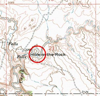
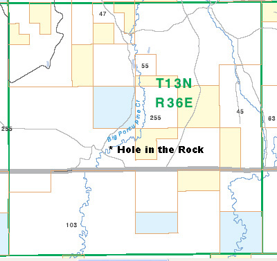
Located in Section
21 R36E T13N it sits on Big Porcupine Creek. According to an earlier
notation, this was the headwaters of Big Porcupine Creek. |
|
|
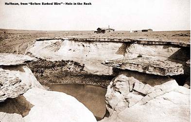
The site is located
on Paul D Shoup's ranch (10,500+ acres) An earlier picture from Huffman’s collection shows how it looked in earlier days. (From “Before Barbed Wire - by Brown …1956”)
|
A current picture
would be very welcome – to post for future travelers to see. (Contact the
WebMaster – Cleve Kimmel)
Part 2 -
Note: This trek also covers two separate Rock
|
Start this segment from
Ingomar ( |
|
|
|
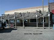
The Jersey Lilly was
originally the Wiley, Clark & Greening Bank; founded in 1914, reorganized
in 1918 as the Ingomar State Bank – then was chartered as the First National
Bank in 1921 & was sent into receivership. In 1933 Clyde Easterday
established the Oasis Bar in it. In 1948 it became the Jersey Lilly. |
|
|
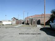
At the rear of the building are two of the most novel & colorful restrooms in the state. Be sure to visit. |
|
This trek can be combined with the travel to Hole in the Rock. Consult the BLM Melstone Map for road connections. The owners of the Jersey Lilly will assist in giving directions. |
|
|
|
|
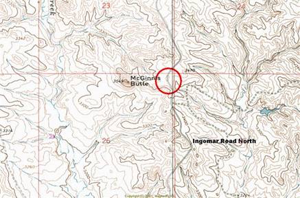
Traveling north from Ingomar, the
|
|
|
|
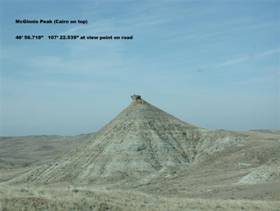
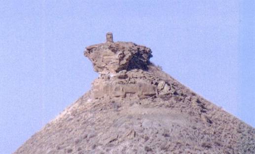
Normal view, ½ mile from the road. |
Rock Cairn is clearly evident on the top. It’s about 6’ tall. |
|
|
The Land Ownership map[1]
shows that 46° 56.710’ N 107° 22.934’ W Note: yellow denotes BLM
land; blue State land. Construction was made by the Army Signal Corps, soon
after |
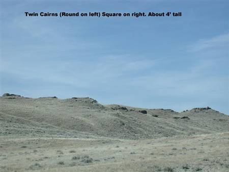
Part 3 – Twin
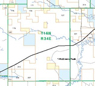
This trek is a continuation of the McGinnis route. Continue
north on
47° 06.026’ N
107° 21.210’ W
The cairns are on the small hill towards the southwest about ½-mile distant. They are located in Section 35, Range 34E T16N.
|
|
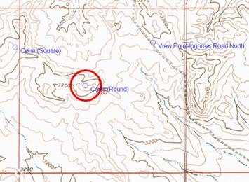
There are two |
|
|
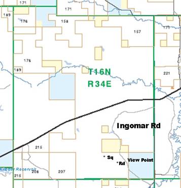
The cairns are located on the CharAngus Ranch Inc property. They have about 28,800 acres. The “black Line” is highway 200.
|
|
|
|
 This
is a “poor” enlargement of the square cairn. The round one needs higher
resolution to see properly.
This
is a “poor” enlargement of the square cairn. The round one needs higher
resolution to see properly.[1] Montana Department of Fish, Wildlife & Parks (//nris.mt.gov/) Melstone Map
![]() Email
me:
Email
me:
Katy Hestand
Yellowstone County Coordinator
© 2014 MTGenWeb