|
|
 - -  Out in the Boonies (Trip # 11 ) |
|
Pompeys Pillar |
By Dave Dodge & Cleve Kimmel |
|
|
Reed Point to Stockade School & Rock |
Saturday, October 31, 2009 Revised to correct links
This trek is about a
six-hour round trip drive from
NGIS
DD.DDDDD
GPS DD
MM.MM, DD MMMM OR DD MM SSS
Directions:
Starting from Billings, take the I90 Freeway towards
Butte, and get off at Exit 400 and circle through Reed Point, cross the
Stillwater River, north to the Stockade School and two cairns, and then cross
back south to observe another cairn.
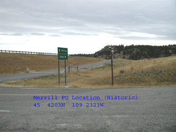
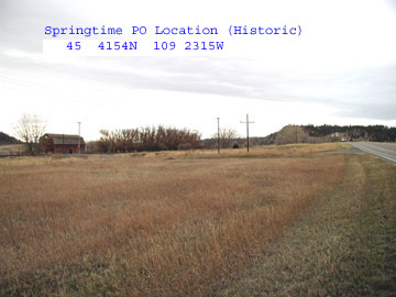
Part 1 – Merrill & Stillwater Post Offices.
The Merrill PO opened in 1890 and
operated until 1910. It was then closed and eventually it and the local town
merged with Springtime. The Springtime PO operated from 1917 until 1932. They
were about ¼ mile apart. To reach Springtime, pass under the I90 Freeway, turn
left and go east about 200 yards.
|
|
|
http://www.satelliteviews.net/cgi-bin/g.cgi?fid=1726885&state=MT&ftype=po
provides an aerial image of Merrill PO’s location.
http://www.satelliteviews.net/cgi-bin/g.cgi?fid=1726985&state=MT&ftype=po
provides an aerial image of Springtime PO’s location.
Note: Use the ZOOM control to get a
real close picture of the above locations.
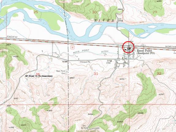
Part 2 – Reed Point Grain Elevators
Turn around on the frontage road at
Stillwater PO location and head west on the I-90 to Reed Point [Exit 392]. Reed
Point carried various names, and at the time the railroad siding was in
operation, it was generally referred to as Reedpoint Siding in some personal
communications. For variations on the name, consult the POLK City Directories
for a complete listing.
|
|
|
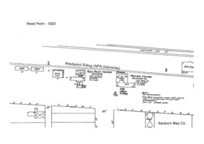
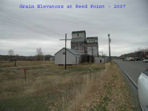
Very little has changed since 1923,
excepting that the siding track has been removed.
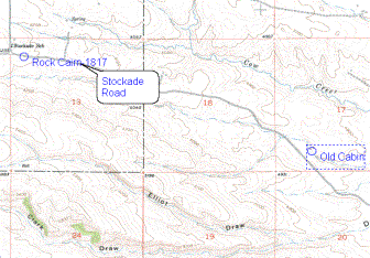
Part 3 – Travel to Stockade School
and two Rock Cairns.
Take MT Road 12 south. It will join
up with Absarokee. Watch the road pathways very carefully.
The road passes
through Section 35 and jogs about until joining Stockade Road. Enroute it has
these names: Rd 12, Jackstone Rd (Small segment), Cow Face Hill Rd, Stockade
Rd, and finally Stillwater Road that joins Absarokee after crossing the
Stillwater River.
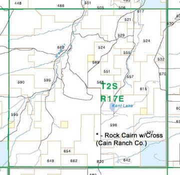
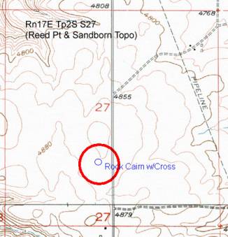
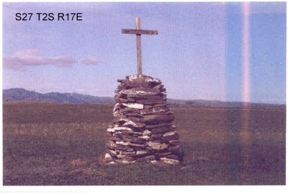
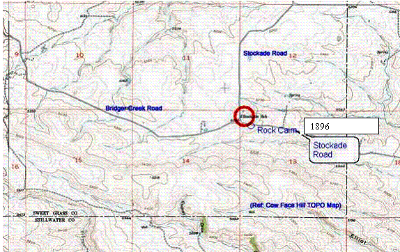
When you reach Section 27,
R17E Tp 2S in Sweetgrass County you will see a rock cairn on private land
that has a wooden cross on top. To the south are the remains of a former stone
cabin. Surrounding the cairn is a circle of rocks buried in the soil that are
about 50-75 feet distant from the cairn. The landowner is the Cain Ranch
Company. Permission is required before visiting the site.
Rd 12 (Jack Stone Rd) passes to the west of
the site.
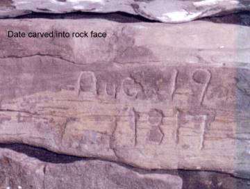
The Rock base is about
seven feet high, and carved into the front face is the date “Aug 19, 1817”
taken by telephoto lens.
|
|
|
|
|
This is the Cairn with the cross. |
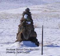
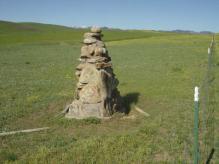
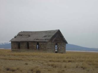
At the junction with Stockade Rd are the schoolhouse and a
rock cairn, cemented in place. The cairn carries a date of 1896.
Aerial view at:
http://www.satelliteviews.net/cgi-bin/g.cgi?fid=777223&state=MT&ftype=school
After
visiting this site, take the Stockade Road to the east. It joins with
Stillwater Road, which leads into Absarokee.
|
|
|
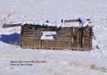
At 45 34.029 &
109 39.539 off to the east of
Stockade Road is an interesting old cabin (shown on the right). Who says that
Montana doesn’t have luxurious accommodations? The one on the left (without
snow) is for city folks.
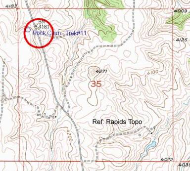
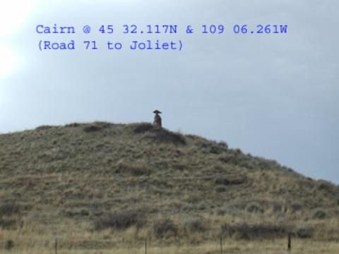
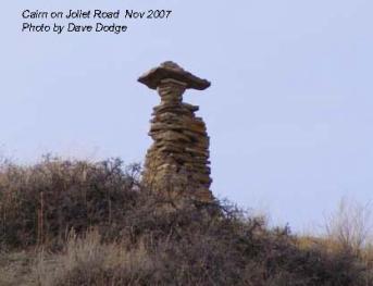
Part 4 – Rock Cairn on MT Road 71
After leaving Absarokee
take Hwy 78 NW to Columbus, and connect with Joliet Road (Hwy 71) going SE.
About halfway to Joliet you will pas from Stillwater County into Carbon County.
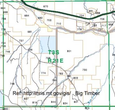
The Cairn is in the NW ¼ of Section 35 Rn21E Tp2S, and sits on the “Brastrup” S
Ranch LLC Property.
|
|
|